Nant-yr-Arian Mountain Bike Trails situated just inland from Aberystwyth offers stunning high-level wilderness riding with 2 Red and 1 epic Black graded trails.
The Syfydrin trail combines the best of the ‘ Summit trail’ singletrack with backcountry mountain tracks for a 35km wilderness loop. The 16km Summit trail and 9km Pendam trail use twisting all weather singletrack carved into the steep valleys and ridges of the forest to create shorter, but no less challenging route options.
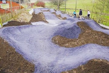
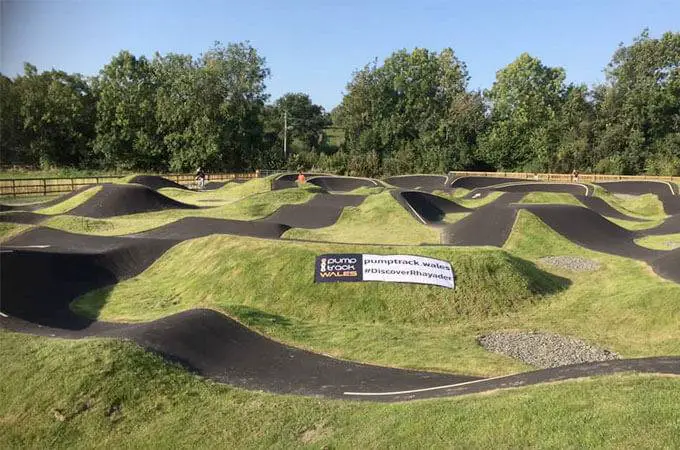
The mountain bike skills area is centre’s newest facility will provide riders with the opportunity to learn new skills and improve their existing ones on 3 graded tracks of increasing difficulty.
Mountain Bike & Cycle Trails at Bwlch Nant yr Arian
Arian Trail (Green 7.9km)
The Arian Trail offers a family-friendly experience leading to scenic Blaenmelindwr lake. This accessible route follows forest roads with a public road section around the lake and includes a brief steep climb on return. Please remain alert for vehicles and respect other trail users.
Melindwr Trail (Blue 5km)
The Melindwr Trail helps riders advance from blue grade trails to the next level. It features two loops totaling 5 kilometers.
Loop 1 (under 2 km) includes a forest road climb, a scenic viewpoint with bench, and a flowing descent with berms back to the visitor center.
Loop 2 begins on 'Italian Job' before descending 'Half Pipe.' Navigate the shared two-way section carefully before climbing 'The Nose' for ocean views. Rest at the bench before enjoying a flowing descent with rollers and berms. Though the forest road climb reaches 12% gradient, the exciting final descent makes it worthwhile.
Pendam Trail (Red 10.2km)
The Pendam Trail strings together some of the best flowing sections in Nant yr Arian with relatively short climbs. With sections like ‘Italian Job’, ‘Hippity Hop’ and a fun final decent on ‘High as a Kite’, it’s a real blast!
Summit Trail (Red 18.5km)
Summit is the longer more challenging red-grade trail which weaves its way through the forest and takes you out onto the exposed moorland. ‘Mark of Zorro’ gives a fantastic long descent, well worth the following climb up the ‘Leg Burner’.
Syfydrin Trail (Black 36km)
The Syfydrin Trail takes in all of the Summit Trail with its fantastic swooping, flowing singletrack, and adds to it by leading you out onto the high open hills with stunning views.
Parc Sgiliau (skills park)
The skills park is a purpose-built track for mountain bikers to practice their technique or just warm up before hitting the longer trails which start from the visitor centre. Features include rollers, step ups, berms, tabletops, hips and bowls.
How to get here
Bwlch Nant yr Arian Forest Visitor Centre is located 2 miles west of the village of Ponterwyd and 10 miles east of the coastal town of Aberystwyth on the A44.
SAT NAV: SY23 3AD This will take you to Ponterwyd. Please follow the green roadside Forestry Commission signs for directions to Bwlch Nant yr Arian.



 Parking
 Toilets
 Cafe
 E-Bikes Allowed