Share this page

Facebook Twitter LinkedIn Email

Ballymoyle Hill Mountain Biking Trails

0 reviews

Ride the exciting blue and black diamond mountain bike trails at Ballymoyle Hill. Located just 9km from Arklow, this trail system offers thrills for every skill level. Read more


place Barranisky, County Wicklow, VV58 3MV

link www.coillte.ie


Open - All Clear

Videos

Share your videos of Ballymoyle Hill Mountain Biking Trails

Add A Video

Photos

Share your photos of Ballymoyle Hill Mountain Biking Trails

Add A Photo

Description

Ballymoyle Hill Mountain Bike Trails in Arklow, Ireland

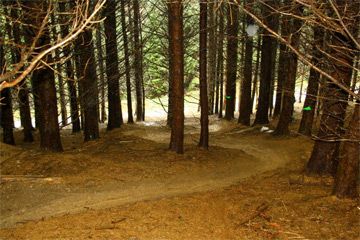
The Ballymoyle Hill Mountain Biking Trail System is located approximately 9km north of Arklow, Ireland. Ballymoyle Hill reaches an elevation of 240 meters above sea level, providing ideal terrain for downhill mountain biking on its purpose-built trail network winding through the surrounding forest.

The trail system features multiple routes of varying difficulty, including blue and black diamond trails. Riders can choose from fast-flowing trails with small jumps and technical features or more advanced trails with steep climbs and descents connected by sections containing flow trails and gap jumps.  

Under license from Coillte, the land manager, the Hush MTB Club is responsible for constructing, maintaining, and managing the mountain bike trails.

As the forest is also a popular area for hiking, the mountain biking and walking trails intersect at points. Riders should exercise caution when exiting trails and yield to pedestrians.

How to get here

From Arklow, turn left 100 metres before Jack Whites pub. Take the next left and go straight on for 1 km approx until you meet the forest. Keep right until you reach the entrance on your left. Cars to be parked outside the barrier

Facilities

  • Parking Parking
  • E-Bikes Allowed E-Bikes Allowed

Location

Nearest Town: Barranisky, County Wicklow
Website: www.coillte.ie
Sat Nav: VV58 3MV

Want to view the location of this trail?
Login or Sign-up by clicking the button below.

Register Sign In

Trail Leaderboard

Nearby Trails

Please note: Distance is calculated as air distance or "as the crow flies" the most direct route between two points, so the distance by road maybe slightly longer.

Nearby Accommodation

Submitted by:
Last modified: 2024-02-11 18:18:29

Disclaimer: All trails and location details have been submitted to this website by independent contributors and resources. We hold no personal responsibility for the accuracy or legality of any trail description or location published herein. All listings are for information only.