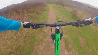
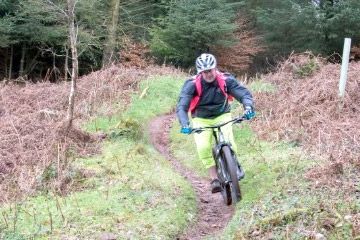
Videos
Quantocks Natural

Trail Reviews Summary

Description
A Sunday ride route which is quick drop down through Holford Combe from Deadwomens ditch, then up through Hodders Combe, Lady's Edge, Bicknoller Post, Crowcombe Park Gate and back to Dead Womens Ditch.
Accessable from many a car parking stop, and a couple of good local pubs. Situated not far from Taunton, Bridgwater or Minehead in Somerset.
THIS IS NOT AN OFFICIAL GUIDE, ITS JUST ONE OF THE POPULAR ROUTES I (martin_fry) USE TO PERSONALLY RIDE OVER THE MANY YEARS I LIVED NEAR THE QUANTOCKS, OFFICIALLY I GUESS YOU SHOULD ONLY RIDE ON THE BRIDAL PATHS AND GREENLANES.
PLEASE RESPECT THE AREA AND ITS OTHER USERS AS BIKERS REPUTAIONS IN THE AREA ARENT THE BEST, HENSE NO OFFICIAL PROMOTION OF BIKING FOR THIS AREA, WHICH IS A REAL SHAME, AND A BIT OF A JOKE AS THERE A PICTURE OF A MOUNTAIN BIKER ON THE FRONT COVER OF THE MAP
THIS TRAIL MAP AVAILABLE FOR DOWNLOAD WAS TRACED FROM THE FOLLOWING OS EXPLORER MAP 140 "QUANTOCK HILLS & BRIDGWATER"
THIS IS ONLY A SMALL EXAMPLE OF THE MOUNTAIN BIKING ON THE QUANTOCKS, JOIN THIS WITH OTHER QUANTOCK TRAILS I HAVE UPLOADED TO MAKE A LONGER RIDE IF IT SUITES YOU, OR GRAB YOURSELF AND OS MAP AND EXPLORE THIS VERY RIDABLE AND VARIED TERRAIN.
Facilities
Location


Nearby Trails
Triscombe Mountain Bike Trails
(1.6 miles)
North Petherton Pump Track
(6.5 miles)
Puriton Pump Track
(7.1 miles)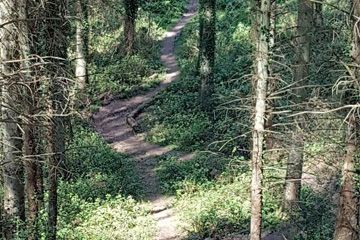
Dunkery & Horner Woods Mountain Bike Trails
(7.3 miles)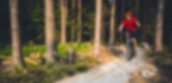
Weston Super Mare Pump Track
(10.4 miles)Please note: Distance is calculated as air distance or "as the crow flies" the most direct route between two points, so the distance by road maybe slightly longer.
Nearby Accommodation


The Old Cider House
5.2 miles from venue
Travelodge Wellington Somerset Hotel
11.4 miles from venue
Travelodge Caerphilly Hotel
29.5 miles from venue
The Mount Pleasant Inn
37.5 miles from venue
Station House
39.9 miles from venue
Last modified: 2018-06-06 08:16:53
Disclaimer: All trails and location details have been submitted to this website by independent contributors and resources. We hold no personal responsibility for the accuracy or legality of any trail description or location published herein. All listings are for information only.